As the 2024 Atlantic hurricane season continues, the development of storm system Nadine is being closely monitored by meteorologists
Currently known as ‘Invest AL94,’ Nadine shows signs of potential intensification, possibly becoming a tropical storm or even a hurricane. Meteorologists are closely monitoring its trajectory and strength, especially following a series of recent storms in the region.
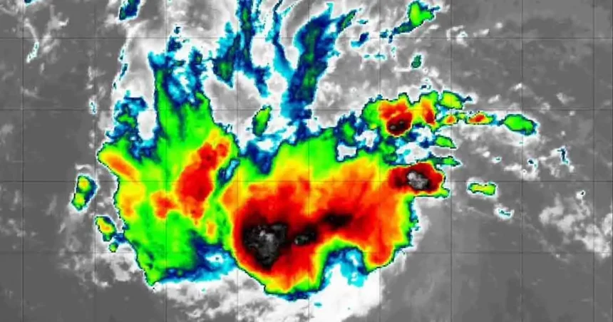
Nadine: A Growing Concern in the Atlantic
Situated in the eastern tropical Atlantic, west of the Cabo Verde Islands, Nadine currently has winds of 28 miles per hour. The National Hurricane Center (NHC) indicates a 30% chance that the storm could develop into Tropical Storm Nadine within the next 48 hours, with a 40% chance of doing so within the next seven days. As it moves westward across warmer waters, conditions may become favorable for further growth, potentially reaching hurricane status with winds exceeding 73 miles per hour.
CBS meteorologist Joe Ruch noted that Nadine is “showing signs of life” based on radar footage captured earlier in the week. The storm is forecasted to move westward to west-northwestward, with gradual development expected later in the week.
Projected Path and Potential Impact
If Nadine continues to develop, its path may lead it towards the Caribbean. A “spaghetti model” shows a trajectory that could pass north of Antigua and Barbuda, potentially affecting the Dominican Republic, southern Cuba, and Jamaica. While the storm is not currently expected to head directly for Florida, forecasters warn of potential hazardous conditions in the Caribbean.
AccuWeather forecasters advise that if Nadine gains strength, it could bring heavy rainfall and strong winds to the region, posing a risk of mudslides and coastal flooding. While Florida is not under direct threat, caution is advised due to potential onshore winds causing rough surf and rip currents.
Conclusion
As Nadine’s development continues, there is a possibility of it strengthening into a hurricane and affecting parts of the Caribbean. Residents in potentially affected areas are urged to stay informed and prepared for any changes in the storm’s path. Official updates from the National Hurricane Center should be closely followed as the situation evolves.